UK Space Agency
Featured
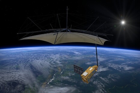
A satellite developed by British academics and engineers is set to become the first in the world to measure the condition of the Earth’s forests in 3D from space.
UK and Cyprus strengthen space ties
News story
Cyprus and the UK are set to collaborate more closely on space activities following a successful bilateral event held in Nicosia on 27-28 March.

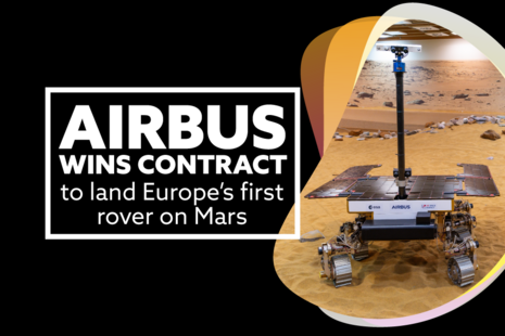
UK firm to land Europe’s first rover on Mars
Press release
A UK aerospace company is set to land the first European rover on the red planet, as it wins £150 million to complete the touchdown system delivering the rover safely to Mars.
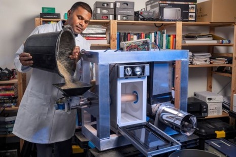
Lunar microwave to purify water frozen in Moon’s soil wins UK Space Agency’s Aqualunar Challenge
Press release
A transformational technology that uses microwaves to defrost and ultrasound to break down contaminants in melted lunar ice to provide clean, drinkable water for astronauts has won the UK Space Agency-funded Aqualunar Challenge.
Cutting-edge UK research is benefiting the European Space Agency’s Euclid mission, with new data released today (19 March) set to uncover the secrets of dark energy and matter.

The UK Space Agency and the Scouts have launched a brand-new Space Activity Badge for Explorer Scouts.
Latest from the UK Space Agency
What we do
We support the government to boost UK prosperity, understand the Universe, and protect our planet and outer space.
UK Space Agency is an executive agency, sponsored by the Department for Science, Innovation and Technology.
Follow us
Documents
Transparency and freedom of information releases
Our management


Contact the UK Space Agency
Contact
Quad Two Building (1st Floor) Rutherford Avenue
Didcot
Oxfordshire
OX11 0DF
United Kingdom
Make an FOI request
- Read about the Freedom of Information (FOI) Act and how to make a request.
- Check our previous releases to see if we’ve already answered your question.
- Make a new request by contacting us using the details below.
Freedom of Information requests
Quad Two Building (1st Floor) Rutherford Avenue
Didcot
Oxfordshire
OX11 0DF
United Kingdom
High profile groups within the UK Space Agency
Corporate information
Jobs and contracts